Are you seeking to visit the National Parks of Georgia? You will find lots of adventure and unforgettable memories on Georgia’s unique natural heritage National Parks.
The Agency of Protected Areas offer a great source of information for travelers. Click here and here and explore more.

Biliki App suggests!
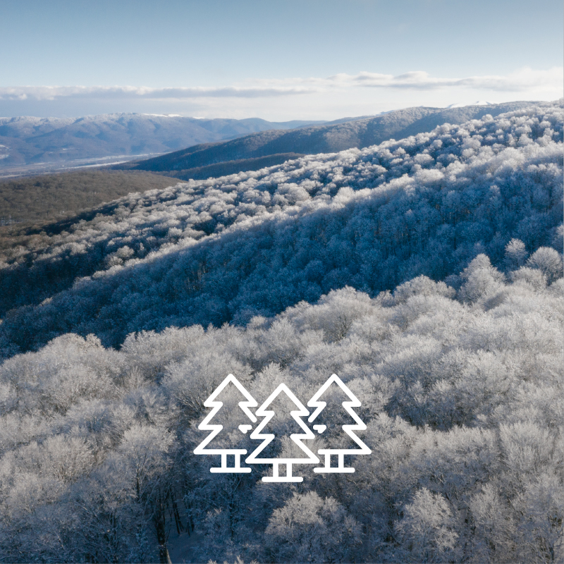
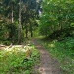
Algeti National Park
If you are tired of your everyday routine and wish to spend a day in nature, Algeti National Park is a wonderful place to visit. 1.5 hour driving from Tbilisi and 16 km of hiking itinerary is can help you to feel the nature and relax. The round route leads through a beautiful forest with eye-catching panoramic views. The hiking tour starts from Manglisi Church follows a ground road and continues with a trail.
Live your Adventure and Enjoy the trip, download the Biliki App to book the trip!
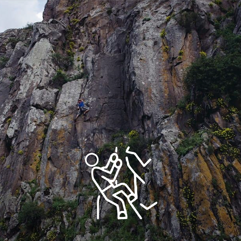
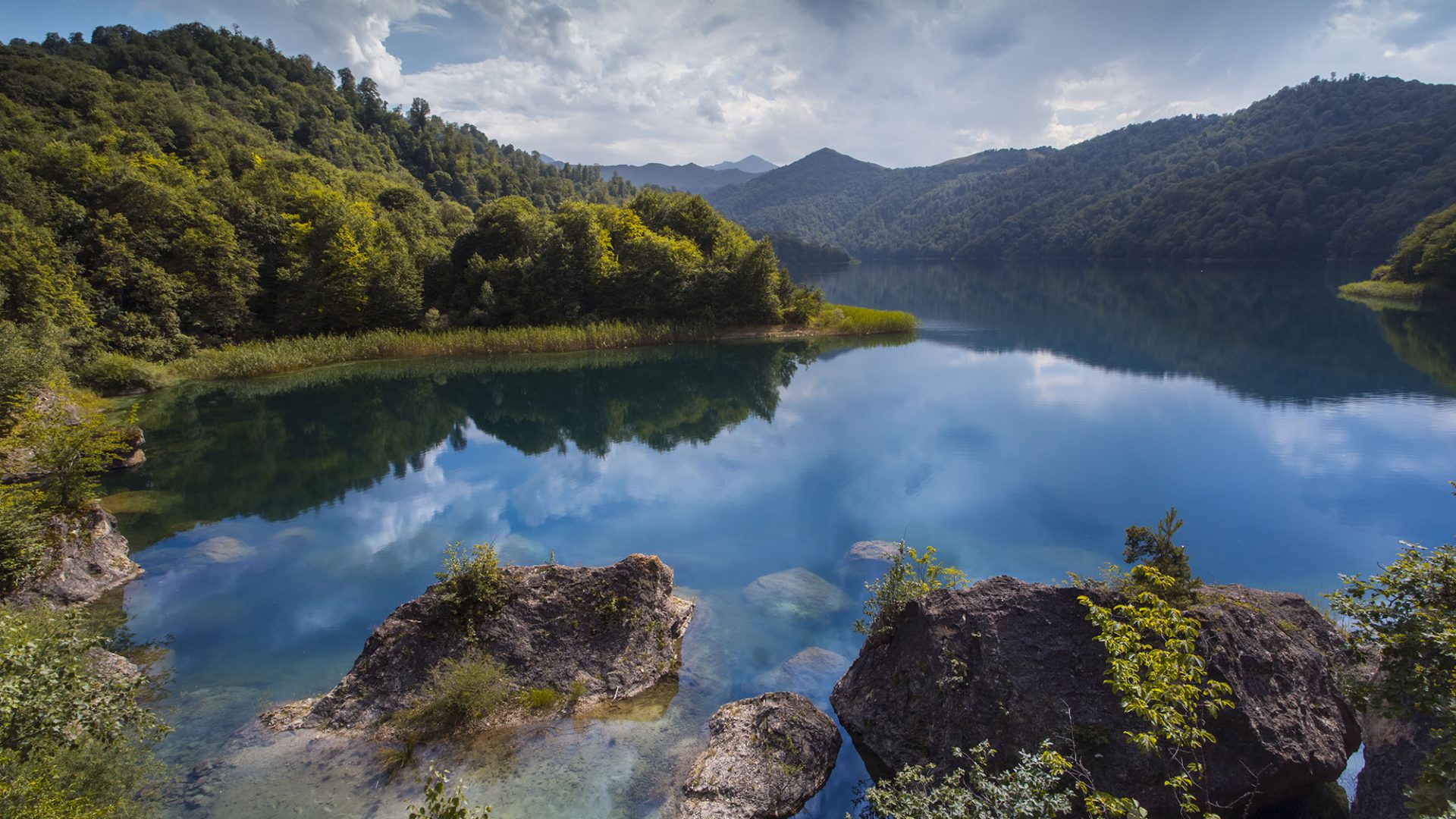
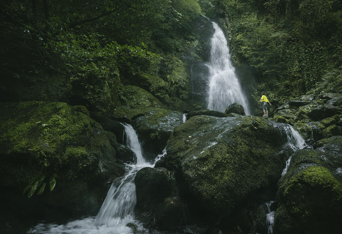
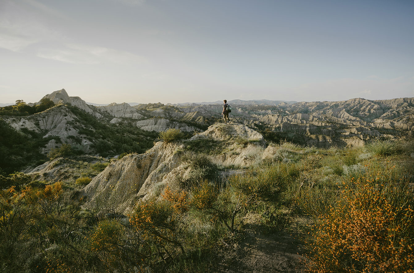
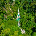
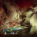
Caves and Canyons of Imereti
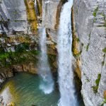
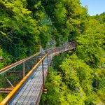
This tour offers you to discover marvellous Natural Monuments of Georgia. You can start a trip from Tbilisi as well as from Kutaisi. During your trip, you will be able to visit the top destinations among the Protected Areas of Georgia such as, Prometheus Cave, Okatse Canyon, Okatse Waterfall, and Sataplia.
Vertiginous tour at Natural Monuments of Imereti will take you on a journey at Okatse Canyon which depth is 140 meters, with 780 meters long hanging trail. You will be able to see stalactites and stalagmites at Prometheus Cave. Do not miss Sataplia Cave and dinosaurs footprints as well.
Live your Adventure and Enjoy the trip, download the Biliki App to book the trip!
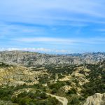
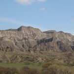
Vashlovani National Park
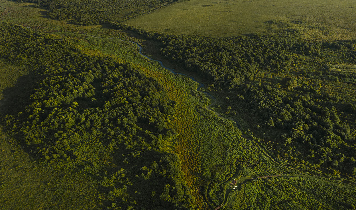
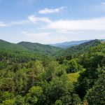
Vashlovani Protected Areas is a mix of National Park and Strict Nature Reserve located in the eastern part of Georgia and was established in 1935 to preserve its unique shallow forests. The area is characterized by its dry climate sitting only 145 meters above sea level.
Tour starts at Dedoplistkaro in Vashlovani Protected Areas Visitors center and continues to Datvis Khevi (The Revine of Bear) which is famous by the footprint of ancient animals and sea molluscs. Do not miss the breathtaking panoramic view at Vashlovani on your way to Datvis Khevi. The trip continues at Alesili Cliffs, where landscape, flora and fauna will remind you of a Safari Tour.
The tour finishes at Mijniskure, which is just a few hundred meters away from the Georgia-Azerbaijan border. Make sure you take some rest by the river where you have an opportunity to stay overnight at the cosy cottages and enjoy sport-fishing at Alazani river as well.
Vashlovani Protected Areas tour gives you a possibility to travel for one or several days, but we recommend to stay at least for two days to enjoy the trip and feel the emotions. The trail is well-marked and tourist infrastructure is comfortably arranged.
Live your Adventure and Enjoy the trip, download the Biliki App to book the trip!
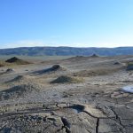
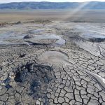
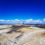
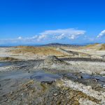
Tour To Takhtitepa Mud Volcanoes
This tour gives you the possibility to discover a far south-east part of Georgia. Vashlovani National Park is located in Dedoplistkaro municipality and it includes Takhtitepa Mud Volcanoes. Takhtitepa Mud Volcanoes are located near Dali Mountain. It is a unique natural monument and exceptional from Georgian nature, even more, it looks like a planet Mars.
On the way, you will see Kilakupra volcanoes are an inorganic natural monument as well as Takhtitepa Mud Volcanoes. Mud and gas are released from volcanoes craters, which has healing properties.
Live your Adventure and Enjoy the trip, download the Biliki App to book the trip!
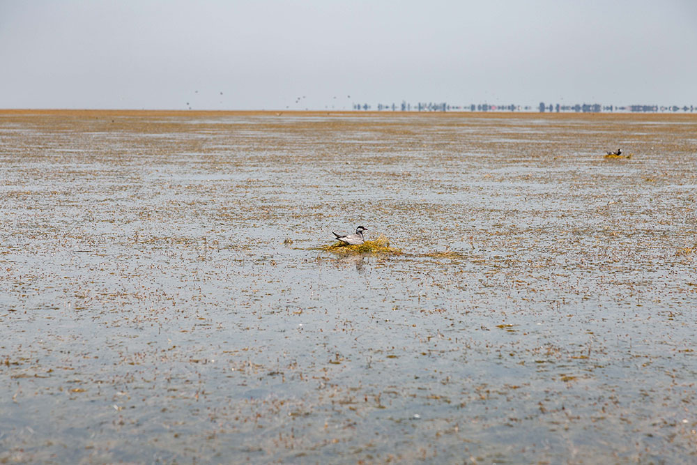
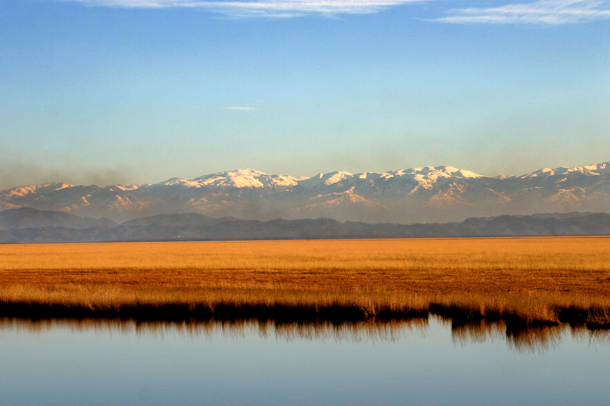
Lake Arpi National Park in Armenia
Visit Lake Apri National Park in Shirak province for a wonderful experience in the wilderness. As an eco-tourist, you will be excited to hear that the park pursues both traditional – conserving biodiversity – and modern-era goals – promoting sustainable community development.
The 21,000-ha territory of the park ranges in altitude from 2,025 m to 3,196 m.
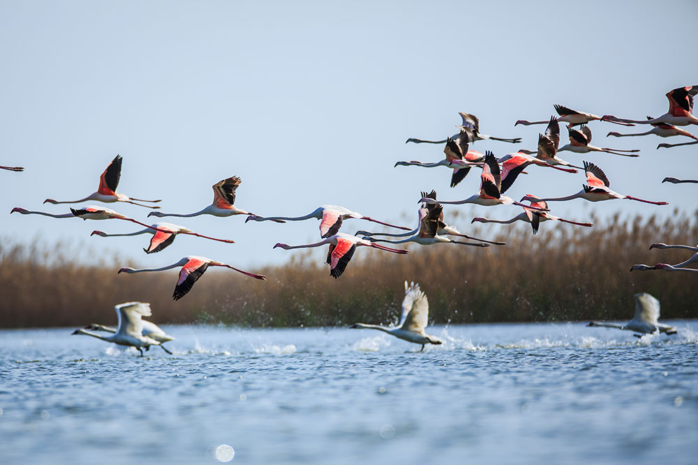
You can observe a diverse landscape with the mountain steppes and subalpine meadows. Don’t forget about Arpi Parks’ wetlands, which are home to:
- Orchids
- Gladiolus
- Alpine auricula
- Meadow saffron
- The Dalmatian pelican
- Armenian Gull
- Eurasian otter
- Brown bear
- Daverski’s viper
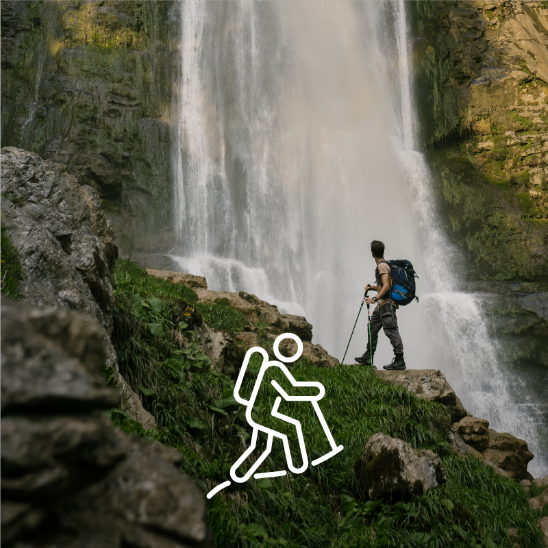
Besides bird watching and observing wildlife, you can have fun with hiking, horse riding, and cross-country skiing.
You can arrange accommodation at a guesthouse in Berdashen and Ardenis village or book a room in a hotel in Torosgyugh village or Gyumri town for a trip to the park.
For your tour’s cultural element, visit the monastery complex of Marmashen or the 5,000-year-old temple at Mets Sepasar and the megalith stones at Zuygaghpur.
It takes nearly 3 hours by car and 4 hours by bus to get to the park, as it sits 180 km from Yerevan.
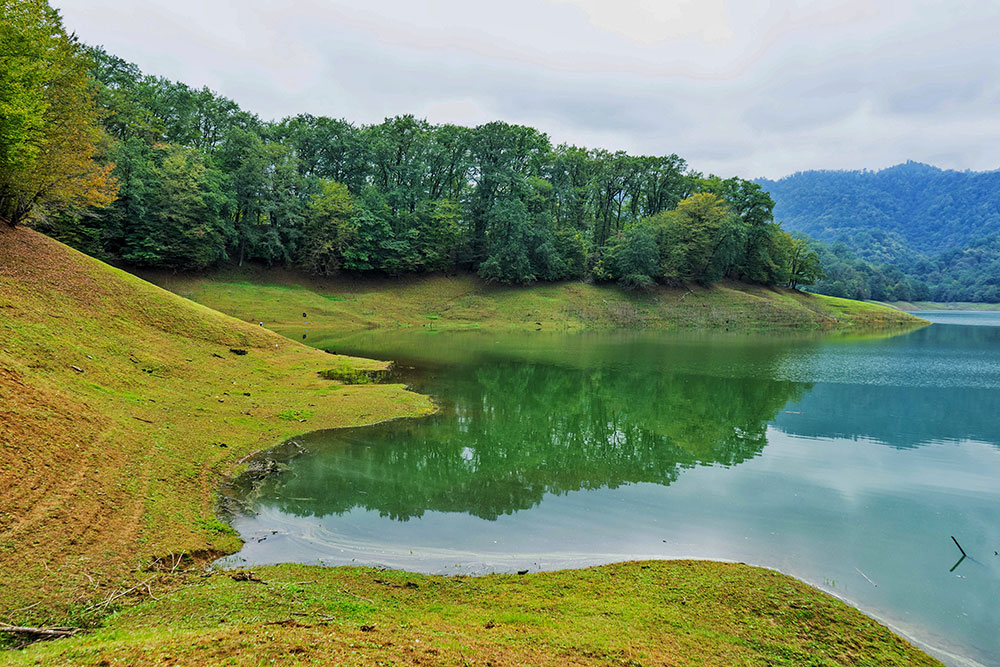
Dilijan National Park
Locals in Tavush province call Dilijan National Park “Little Armenian Switzerland.” The park was established in 2020 and occupied almost 34,000 ha, ranging in altitude from 1,070 m to as high as 2,900 m.
You will enjoy the woods and fauna of Dilijan Park, but what creates a beautiful view that resembles Switzerland is the lakes and rivers, as well as curative mineral springs and high mountainous areas.
Most importantly, the park preserves its famous natural heritage sites: the yew grove of Aghavnavank, the beech woodlands of Haghartsin, the oak woodlands of Khachardzan, Lake Parz, and Lake Tzlka.
The park is widely known among flower lovers for its beautiful wildflower fields and decorative plants. The area has a wide range of wild fruit, berries, and nuts, which you can purchase along with local honey and mineral water.
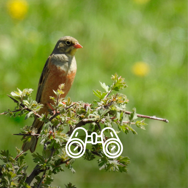
If you’re into birdwatching, you can observe the bearded eagle and Caspian snowcock in Dilijan National Park. The park is also home to deer, brown bears, lynx, and wild cats.
You can enroll in birdwatching tours, camp here in the park, take a hike, enroll in climbing sports, boarding, or cross-country skiing. Don’t forget to visit the Haghartsin Monastery – famous for its beautiful white-stone structures and picturesque surroundings.
Good news! Dilijan National Park is quite close to Yerevan. It takes a little over an hour by car and around 2 hours by bus to reach Dilijan Park. For accommodation, you can book rooms in guesthouses and hotels in Dilijan or camp in the park.
Gyulagarak & Ijevan Dendroparks
In the early 1930s, famous biologist Edmond Leonowicz founded Gyulagarak Dendropark in Armenia’s Lori province. And it has been one of the most popular places for eco-tourists to visit in Armenia since then.
The park is a 15ha-large botanical garden, 17.5ha of which is covered with natural forest and 15ha with ornamental plants.
Overall, this arboretum features a wide variety of trees such as magnolia, cypress, pine, oak, lime, etc. Some of the introduced species are from China, Western Europe, and North America.
The park’s altitude is 1,550 meters above sea level. So pack something warm and cozy, because the climate is quite cold in the area.
Ijevan Dendropark is different. It has a subtropical and semi-arid climate, so warm hiking and wildlife observation is guaranteed. The park covers over 15ha and is home to over 600 rare species of plants and flowers.
Note that you can take a little piece of Armenia with you. The parks sell seeds, so you can buy walnut, maple, and other seed varieties and grow them home.
Aragats
You’ll be amazed to see various wildflowers and endemic species on a mountain that has a harsh and unpredictable climate. It’s the highest mountain in Armenia, with its highest peak at 4090 meters above sea level after all.
Multiple cold-water tributaries come down from Aragats, now an extinct volcano with 250 days of winter weather a year. Wild rabbits, foxes, and wolves call the area their home.
The best time to visit and climb mount Aragats is between June and August. The trails are the driest at this time of the year. If you’d like a challenge, the northern summit is the highest and the most difficult to climb.
You will also find it exciting to observe the visitors’ beloved Lake Kari – an alpine lake situated 3,200m above sea level. And don’t forget about the culturally and historically significant Amberd fortress, built during medieval times. You will also come across monuments from earlier eras there.
 Year of foundation: 2004
Area (hectare): 40358
Location: Within the territory of Lankaran and Astara administrative districts.
The Hirkan National Park is in the Lankaran natural region and protects the landscapes of humid subtropics. The Hirkan National Park consists of a valley area of Lankaran lowland and a mountainous landscape of Talysh Mountains. The Lankaran natural region has rich fauna and flora including many rare and endemic species. Flora of the park consists of 1, 900 species including 162 endemics, 95 rare, and 38 endangered species. There is the iron tree, three-thorned acacia (Gleditschia tricanthos), Zelkova, Quercus Castaneifolia, Fircus hyrcanys, etc. There are many endemics are rare animals, particularly, among the representatives of ground mollusks and non-flying insects. Birds’ endemism is well represented, up to subspecies level, while the species level has a relatively poor representation. The main protected objects are the natural complexes of lowland and low mountainous forest areas of the Lankaran natural region, including the unique well-preserved plot of lower forest, the ecosystem of the rare forest of the Hirkan type.

 Year of foundation: 2008
Area (hectare): 12755
Olduğu yer: territory of Goygol, Dashkasan, and Goranboy districts.
Goygol National Park was established on April 1, 2008, by the Order of the President of Azerbaijan Republic on the base of Goygol State Nature Reserve in the administrative territory of Goygol, Dashkasan, and Goranboy districts. After having the status of National Park, the territory of Goygol State Nature Reserve enlarged from 6739 hectares up to 12 755 hectares. Goygol National Park is located on the North-East part of Lesser Caucasus, on the North Slope of Kapaz Mountain, on 1000-3060 m high from the sea level and encloses medium and high mountain-forest semitones, mountain forest-meadow, subalpine and alpine zones. National Park is called by the name of Goygol Lake. And the reason for that is its transparent water which reflects surrounding green forests and blue sky as a mirror. The principal aim of the establishment of Goygol National Park is protection endemic and endangered flora and fauna species, regulation of the stability of natural complexes, creation of more favorable condition to carry out scientific research works, environmental monitoring, ecological awareness of population and development of ecotourism in the tourist potentially areas. Cold climate with dry winter prevails in the area. The annual temperature of the weather wavers between 4-10 degrees. Annual precipitation is 600-900 mm. The longest river in Goygol National Park is the Aghsuchay – the right branch of the Kurakchay.
 Year of foundation: 2006
Area (hectare): 115895
Location: territory of Guba, Gusar, Ismayilli, Gabala, Oghuz, and Shamakhi districts
Brief description: Shahdag National Park was established in accordance with the decree of the President of the Republic of Azerbaijan № 1814, dated December 8, 2006. Its territory is primarily 115895 ha. Ismayilli and Pirgulu State Nature Reserves consist of 21014 ha, state forest foundation lands located in the administrative territories of Guba, Gusar, Ismayilli, Gabala, Oghuz, and Shamakhi regions compose 81797 ha and useless summer pastures in mountains situated in the heights of boundaries of those regions compose 13084 ha of the National Park. The territory of the National Park was enlarged 14613 ha with the decree of the Cabinet of Ministers of the Republic of Azerbaijan № 193/S, dated July 8, 2010, hence its territory was reached 130508 ha. The aim of the establishment of the Shahdag National Park is rehabilitation, maintenance, and management of global mountain forests and pasture ecosystems located in high mountainous areas including various endemic and endangered species and transboundary migratory animals, preservation of fertile soil layer, protection, reproduction, and enrichment of fauna and flora species characteristic for the area, as well as regulation of natural complex stability, the offer of all necessary facilities for the implementation of scientific-research works, environmental monitoring, environmental enlightenment of population and provision of development of ecotourism in the territory which has great tourism potential. The height of the National Park territory has substantially caused its climatic diversity, fertility of flora soils, and richness of animal planet. The forests located in the territory are popular with rich, fascinating, and picturesque landscapes. Vertical fluctuation and scatter of relief, complex climate conditions, and soil lay have triggered a great diversity of flora.